Chatham
 Extract from 1909 Ordnance Survey
Map reproduced by permission of Medway Archives and Local Studies Centre.
The road running south east, adjacent to the drill hall, at the left hand
side of the image, is Boundary road.
Extract from 1909 Ordnance Survey
Map reproduced by permission of Medway Archives and Local Studies Centre.
The road running south east, adjacent to the drill hall, at the left hand
side of the image, is Boundary road.
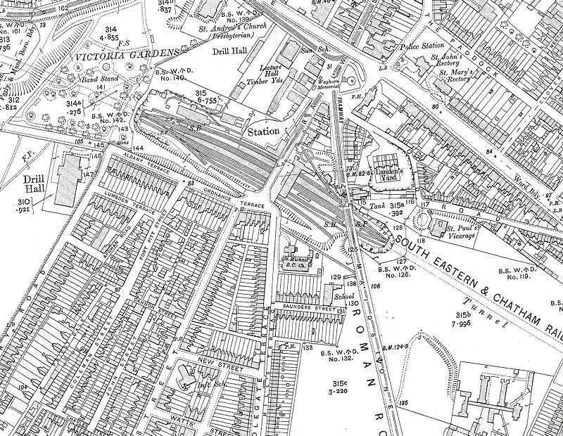
Chatham Drill Hall on 1909 Ordnance Survey
Extract from 1909 Ordnance Survey
Map reproduced by permission of Medway Archives and Local Studies Centre.
The road running south east, adjacent to the drill hall, at the left hand
side of the image, is Boundary road. © All material is copyright - refer to the
Terms of Use
the first attempt at content
Introduction
About
Anatomy
Drill
 Database
Memorabilia
Resources Glossary
Saving Halls Participate Contact What's New? Terms of Use
Drill
Database
MemorabiliaResources Glossary
Saving Halls Participate Contact What's New? Terms of Use
The Drill Hall Project - Charting a neglected legacy